

You can find on this page the Stockholm zipcodes map to print and to download in PDF. The Stockholm zip code map presents postal codes, address lookup and code list of Stockholm in Sweden.
The Stockholm postcodes map shows all the zip codes of Stockholm. This zip code map of Stockholm will allow you to easily find postal codes and address lookup of Stockholm in Sweden. The Stockholm postcode map is downloadable in PDF, printable and free.
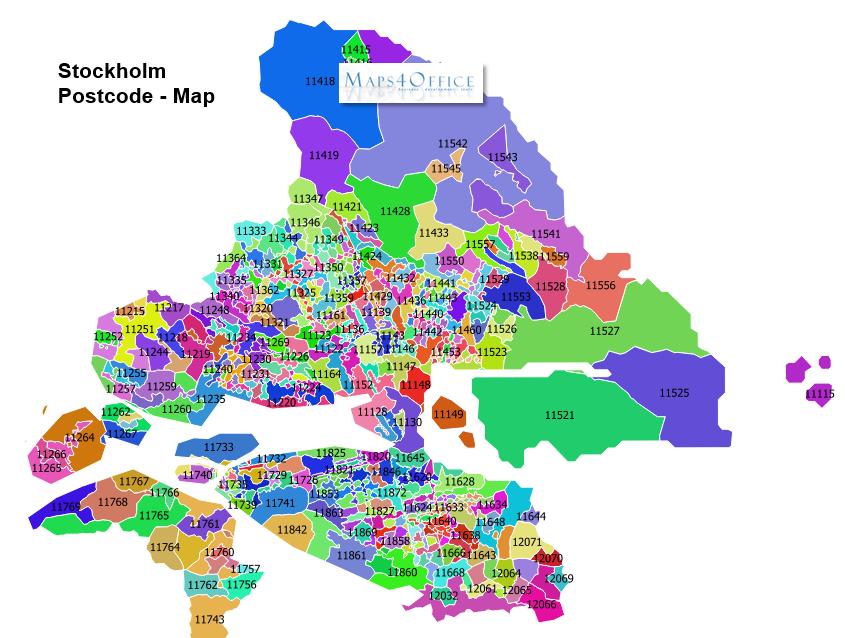
Stockholm postcode consists of 5 digits, divided into two groups of three and two digits. There is a space between the two groups. eg: 102 66 as its mentioned in Stockholm postcodes map. The Swedish Post requires the ISO-2 country code to be used on all international mail items being delivered to Sweden. For domestic mail, ISO-2 code is not required. A double space shall be inserted between the postcode and the location. The location shall be written in capital letters.
Stockholm is the capital of Sweden and the most populous city in the Nordic region its postcode is composed of five digit numbers with a space between the third and fourth eg: 111 81. The three first digit numbers of Stockholm postcode present the outward sorting the last two digit numbers present the inward sorting as you can see in Stockholm postcodes map.
The average area postcodes in Stockholm is 0.331 km² with the largest being 176 76 at 10.8 km² and the smallest being 170 76 at 1,982 m² as its shown in Stockholm postcodes map. In Stockholm the average population for a postcode is 1,389 with the most populated being postcode 168 67 at 8,801. The postcode with the youngest population is 174 62 with a median age of 36.6.